
lesson Plan 2 

General Notes on this pdf...
1. The first map gives you the locations of the "groups" of routes. We've focused on area 5 which covers Carnia and the Julian Alps. I circled area 4 as well which includes the Dolomites, which are an impressive group of canyons, but most of which are located inside the National Park where canyoning is prohibited.
2. The second and third maps are just road maps from Venice (where you'd be flying into) to the proposed lodging locations. Distances from: Venice to Tolmezzo= (2hrs 30min, Venice to Gemona del Friuli (2hrs 15 min, and Venice to Belluno (1hr 50min).
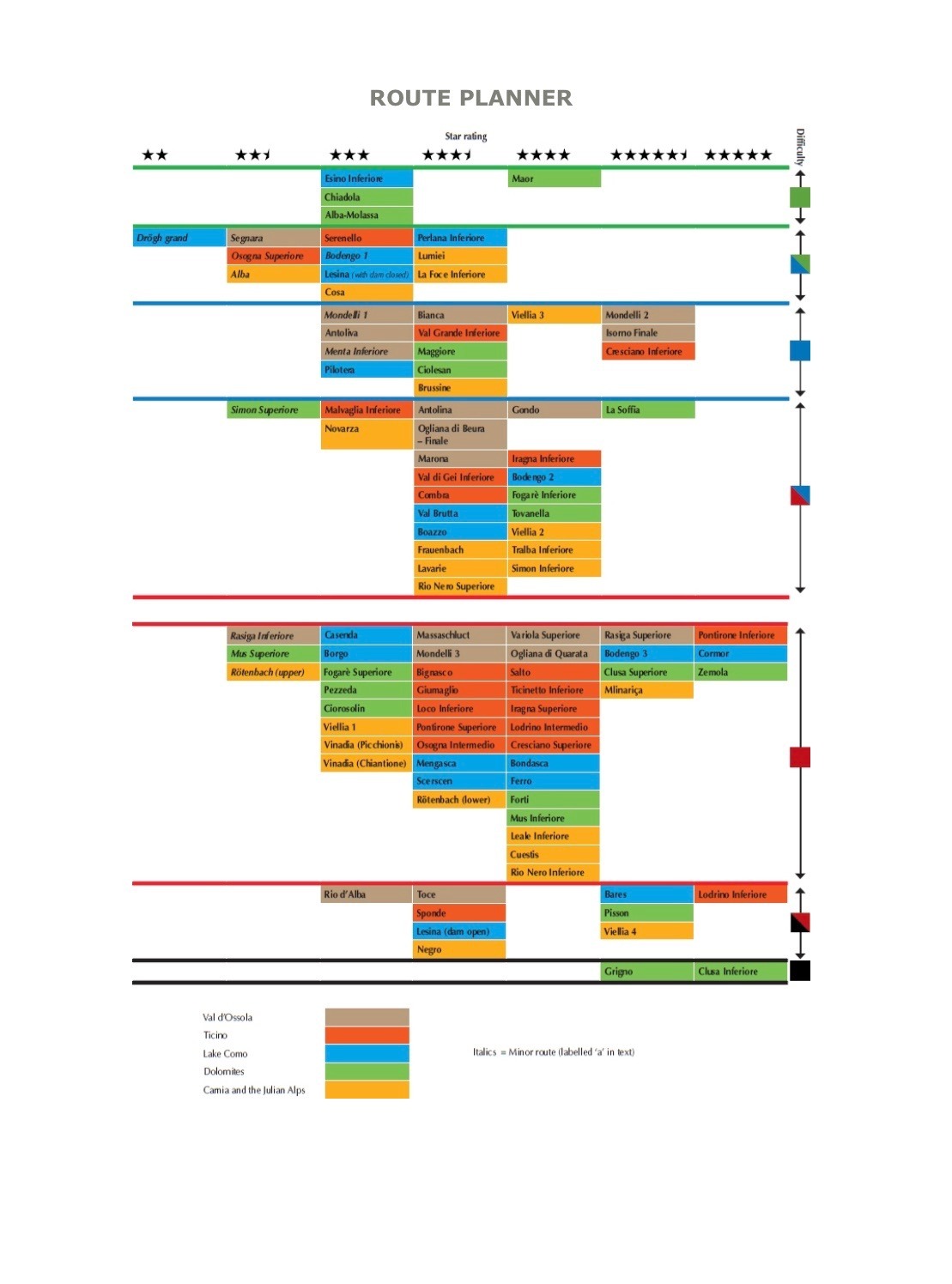
3. The Route planner gives an overview of the ratings, locations, and difficulty levels- we're looking at orange, and/or possibly green.
4. Next two graphs give more detail per route.
5. Last three pages are what the more detailed beta descriptions on the routes cover. Once we confirm with you that the area is approved for travel, we can finalize routes.